


PROCEQ-GS-8000
- Availability: In Stock
- INR 2600000.00 (Inclusive of custom duty)
-
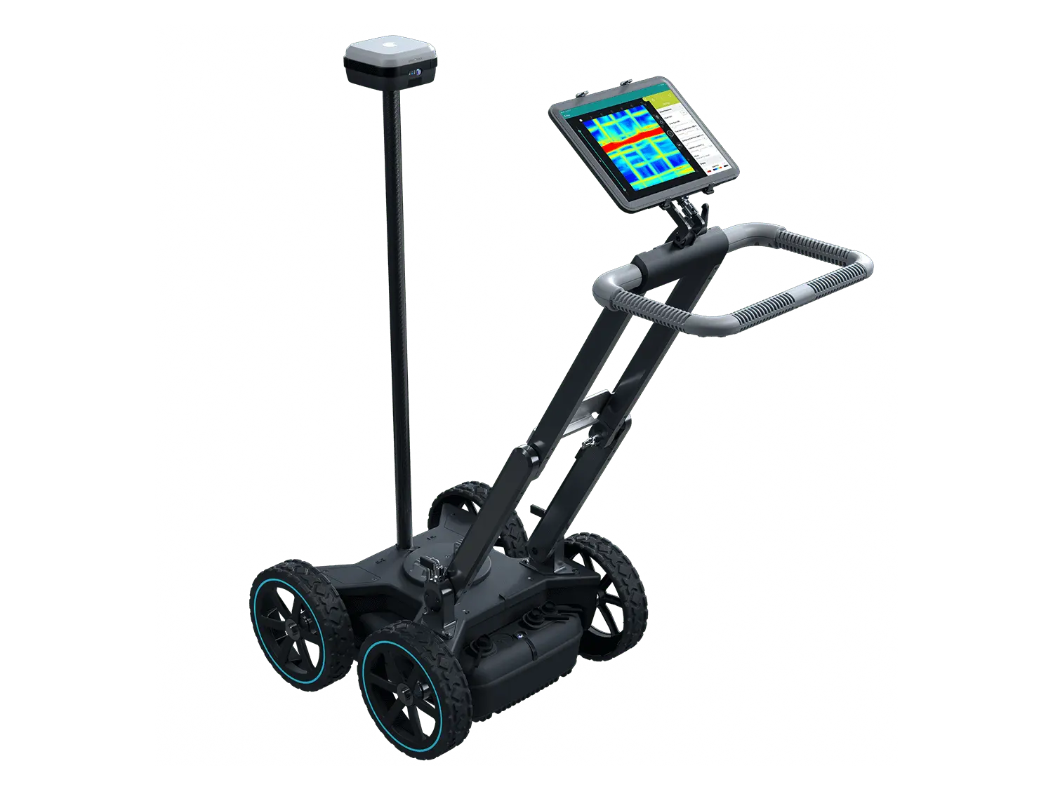
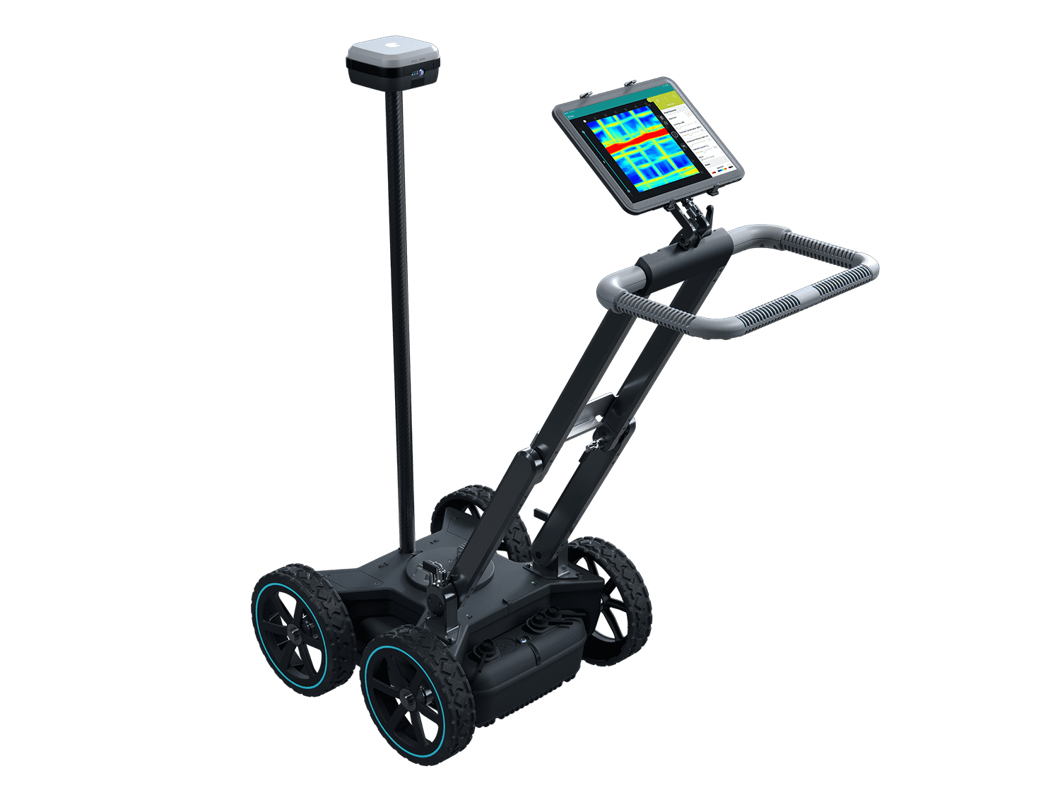
Proceq GPR Subsurface
GS8000
The all-in-one solution for detecting objects and mapping the underground world using SFCW ground penetrating radar technology
Delivery Partners:
Videos
Proceq GPR Subsurface
GS8000
The all-in-one solution for detecting objects and mapping the underground world using SFCW ground penetrating radar technology.
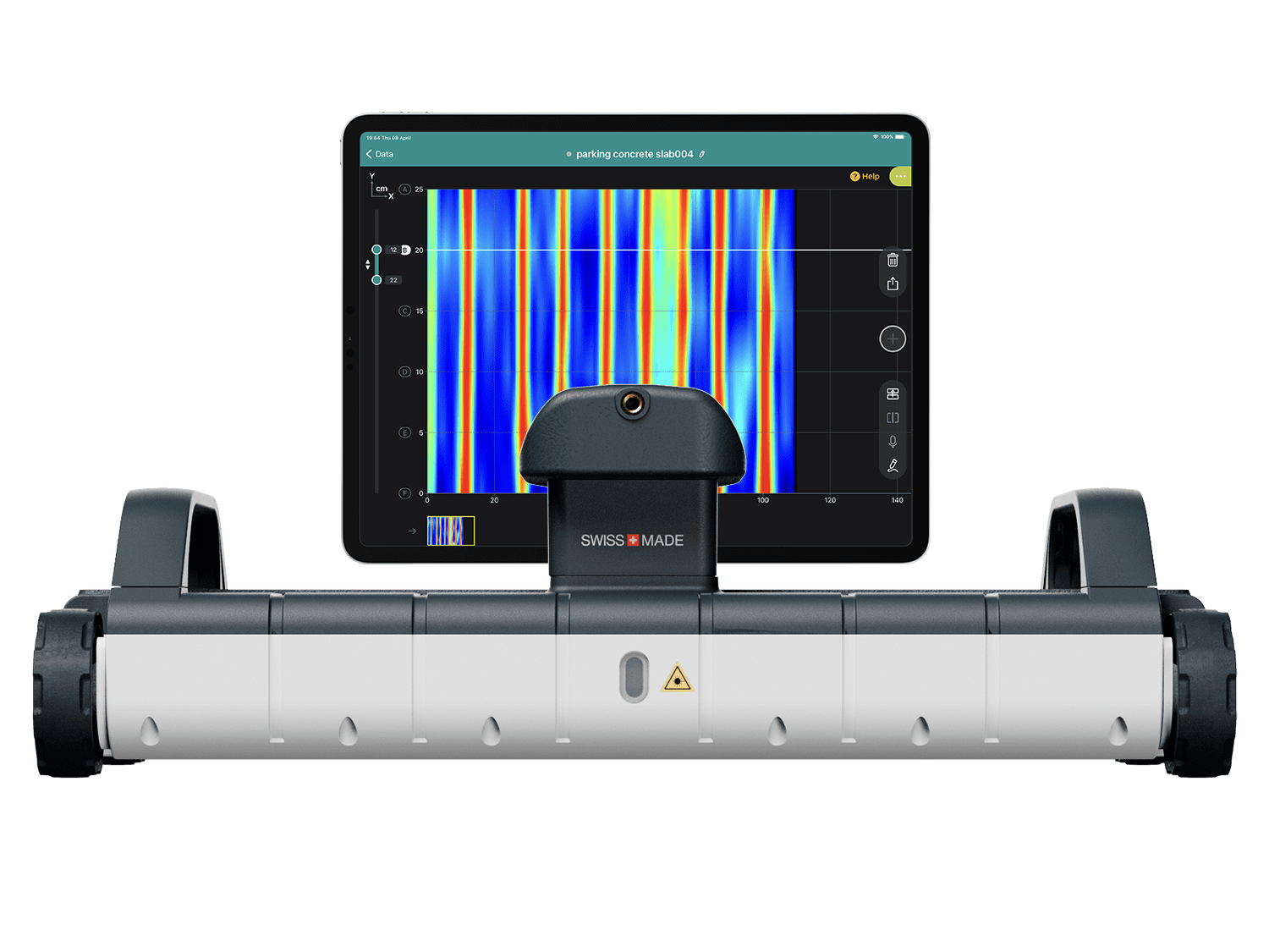
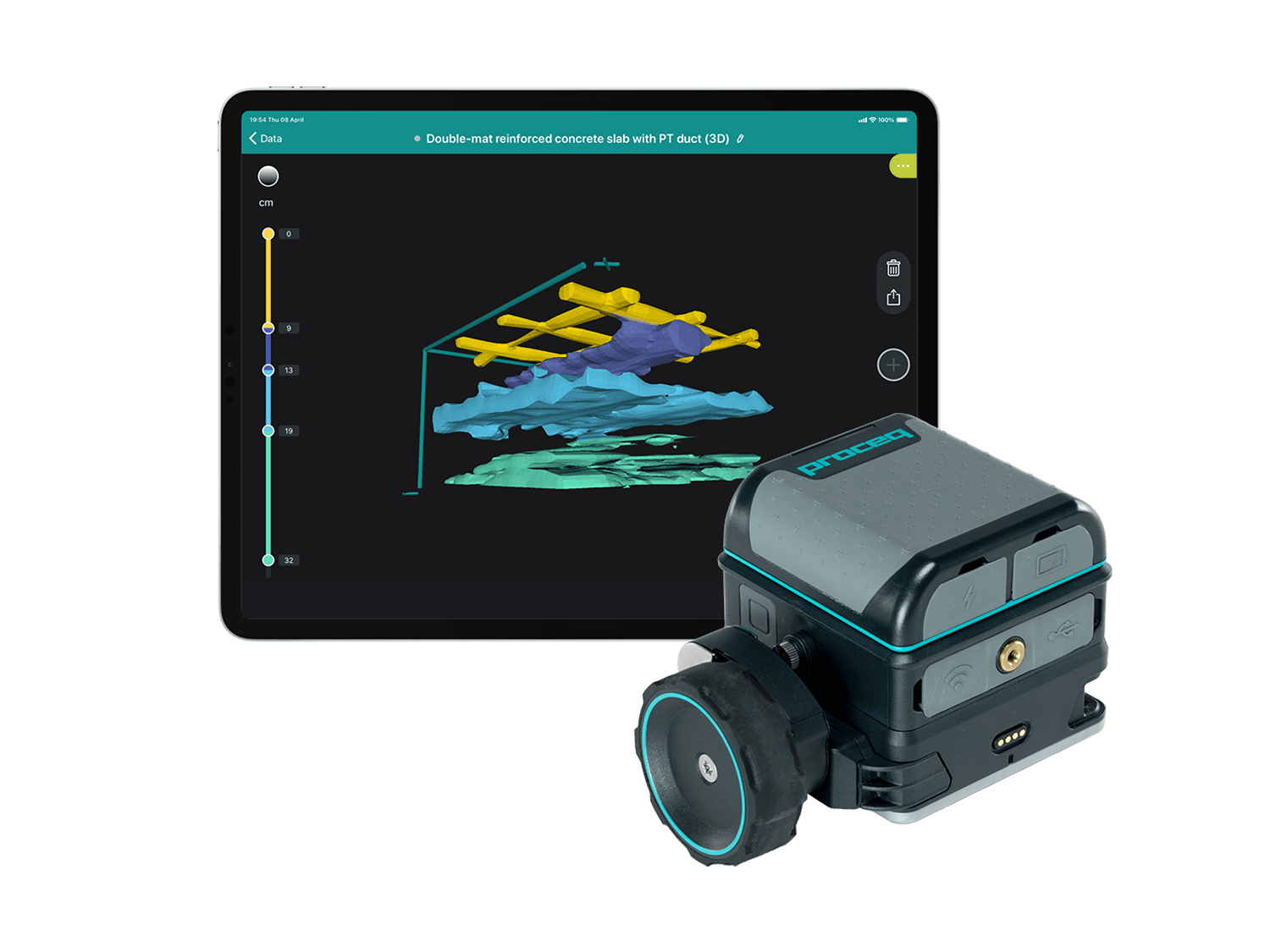
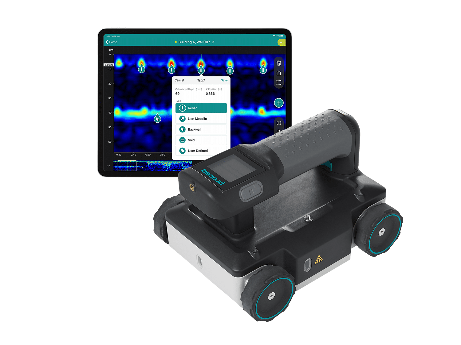
- Intuitive real-time visualization in 2D and 3D
- Superior data clarity, accurately geo-referenced
- Access to your data from anywhere, anytime
Applications:
Utility strike prevention / Subsurface utility engineering (SUE) / Underground 3D Reality Capture / Asset inspection (bridges, asphalt) / Geophysical investigations / Archeology / Forensics / Precision Agriculture
Best-in-class technology. Powerful 3D software. 100% real time. Ideal for experts. Intuitive for all
Productivity
No methodology constraints and real time 2D & 3D data visualization of the scanned subsurface, for an optimal interpretation on site, no matter the application.
Accuracy & Resolution
Superior clarity of data at different depths thanks to the unique Swiss Made ultra-wideband radar technology, with high-accuracy geolocation in local coordinates.
User Experience
End-to-end workflows, all the way from the most intuitive data acquisition to instantly shareable deliverables. Access your data from anywhere, anytime.
| Software / Workspace App | |
| Acquisition modes | Line Scan, Area Scan, Free Path |
| View modes | A-scan, Line Scan non-migrated, Line Scan migrated, Time Slice View, Map View, 3D, Augmented Reality |
| On-site annotations | Tags, markers, points of interest, lines, photos, notes, voice notes, markups |
| Adjustable display settings | Color palette, linear gain, time gain compensation, background removal, multi-layer dielectric constant, time window, noise cancellation filter, frequency filter, low pass filter, slice depth, slice thickness |
| Data options | Cloud storage, SEG-Y export, HTML export, KML export, DXF export, SHP export |
| Display unit | Any iPad or iPad Pro Recommended: iPad Pro WiFi+Cellular (M1) Screen resolution: up to 2732 x 2048 pixels Storage capacity: up to 1 TB |
| Max. scan length | Up to 15 Km | 9.3 mi |
| Max. scan grid size | Up to 80 x 80 m | 260 x 260 ft |
| Sensor | |
| Radar technology | Stepped-frequency Continuous-Wave GPR |
| Modulated frequency range | 40-3440 MHz2 |
| Effective bandwidth | 3200 MHz3 |
| Min. detectable target size | 1 cm | 0.4 in4 |
| Max. depth penetration | 10 m | 33 ft5 |
| Scan rate | 500 Hz |
| Spatial interval | Up to 100 scans/m |
| Acquisition speed | Up to 80 Km/h | 50 mph6 |
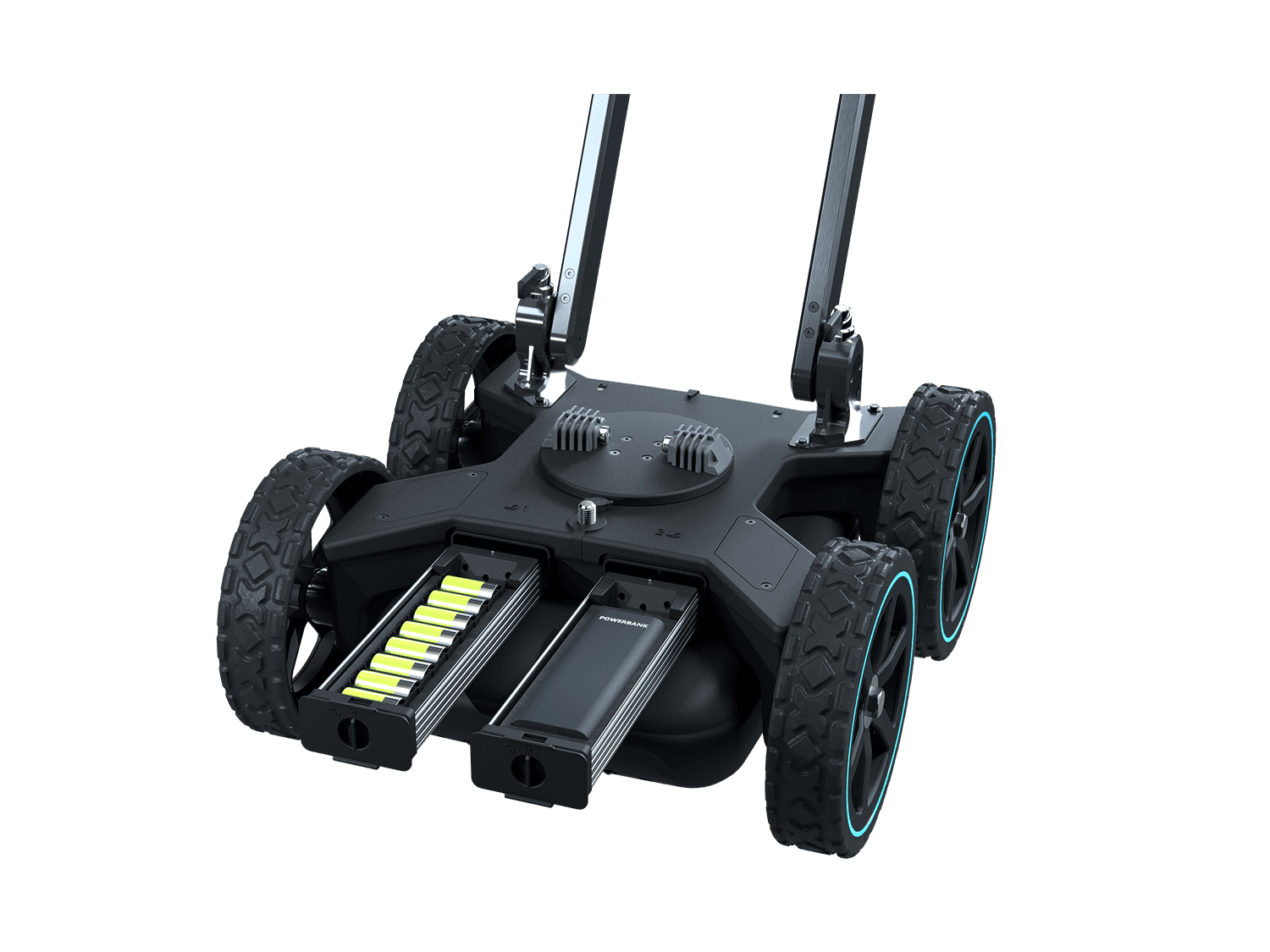
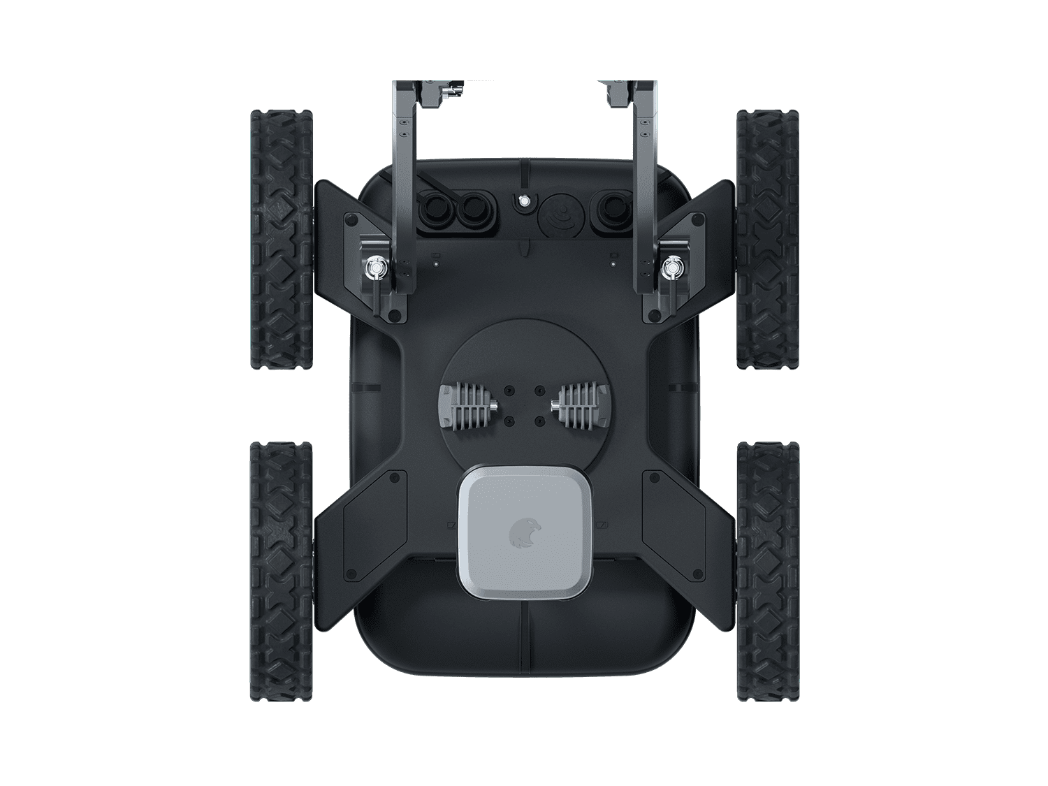
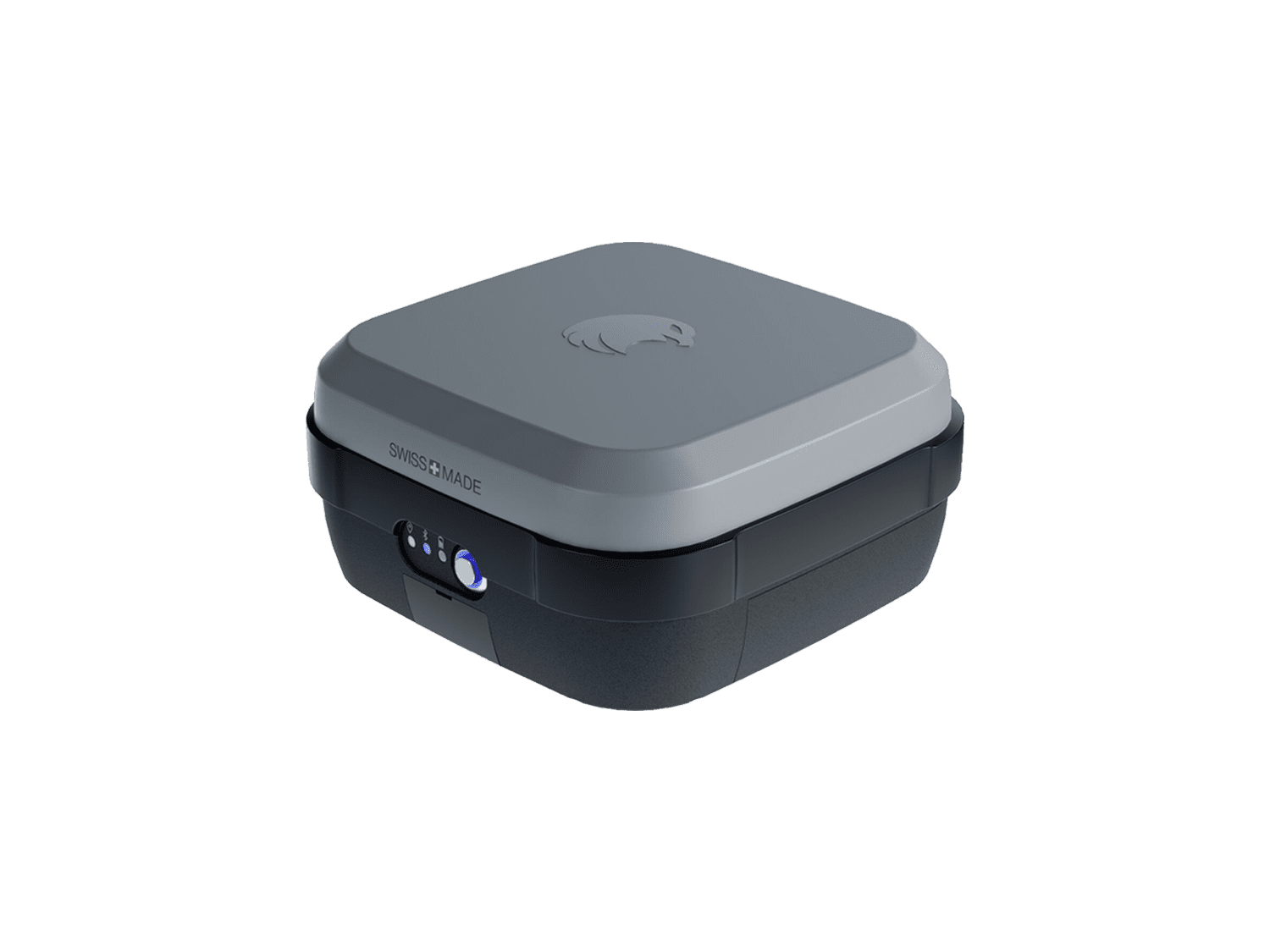
| GNSS receiver | Multiband GPS + Glonass + Galileo + Beidou SSR augmentation ⁷ / RTK-compatible Dimensions: 145 x 145 x 70 mm Weight: 0.7 Kg, 4x AA-batteries included |
| GNSS real-time 3D accuracy | Typ. 1-5 cm | 0.5-2 in 8 |
| GNSS initialization time | Typ. 5-30 s |
| Wheel encoders | 2 |
| Configuration | Wireless integrated push & pull cart |
| Weight | 24 Kg 9 |
| Dimensions | 61 x 57 x 38 cm |
| Antenna positions | Ground-coupled with dual-axis floatingAir-coupled with 25 mm clearance |
| Ingress protection (IP) / sealing | IP65 |
| Power supply | Removable flight-safe battery pack10 | Off-the-shelf power bank11 |
| Autonomy | 3.5 hours | Full working day12 |
| Operating temperature | -10deg to 50degC | 14deg to 122deg F |
| Operating humidity | <95% RH, non-condensing |
| Connectivity | WiFi, Ethernet, USB-A, USB-B, USB-C, Lemo |
Related Products
PROCEQ-GP-8100
INR 1280000.00
PROCEQ-GP-8800 GPR SYSTEM
INR 1200000.00
PROCEQ-GP-8000
INR 1580000.00
